Atchley & Atchley, Inc.
Menu

Miscellaneous Survey Projects


Rooftop Survey Project - LSUS Recreation Center - Shreveport, Louisiana:


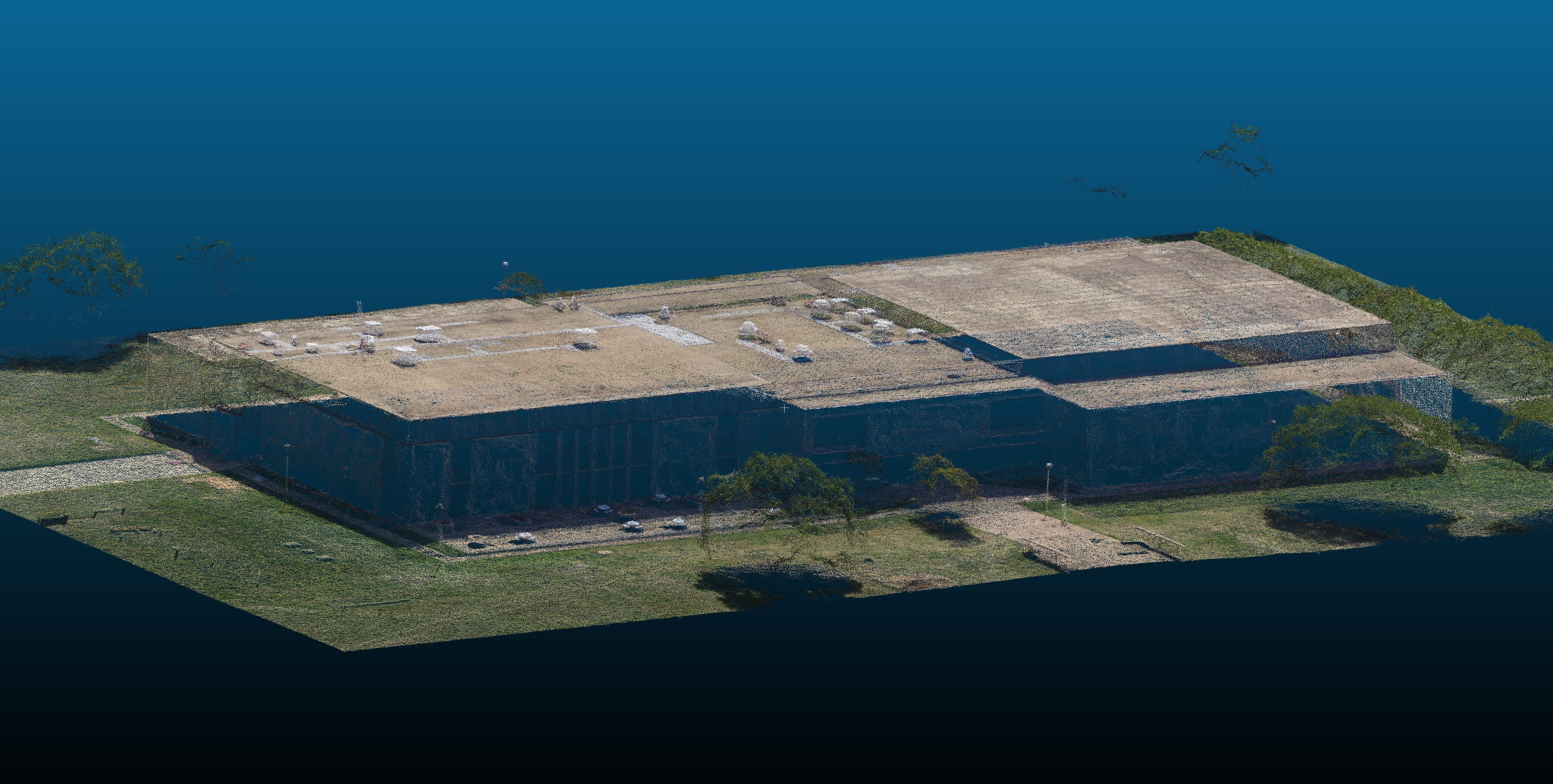
In the interest of safety and efficiency it was determined a drone aerial survey would be the most prudent to accurately obtain the needed data for this project. In order to facilitate this a system of ground control points tie in the point cloud data to the State Plane Coordinate system. This produced an Orthomosaic 2D image as well as a 3D Digital Surface Model (DSM) utilized to generate the survey. This point cloud facilitates making close observations of the site, in addition to obtaining meta data of any point selected. The survey obtained locations of HVAC equipment that was being replaced for the facility.

Oil Pad Geolocation Project:
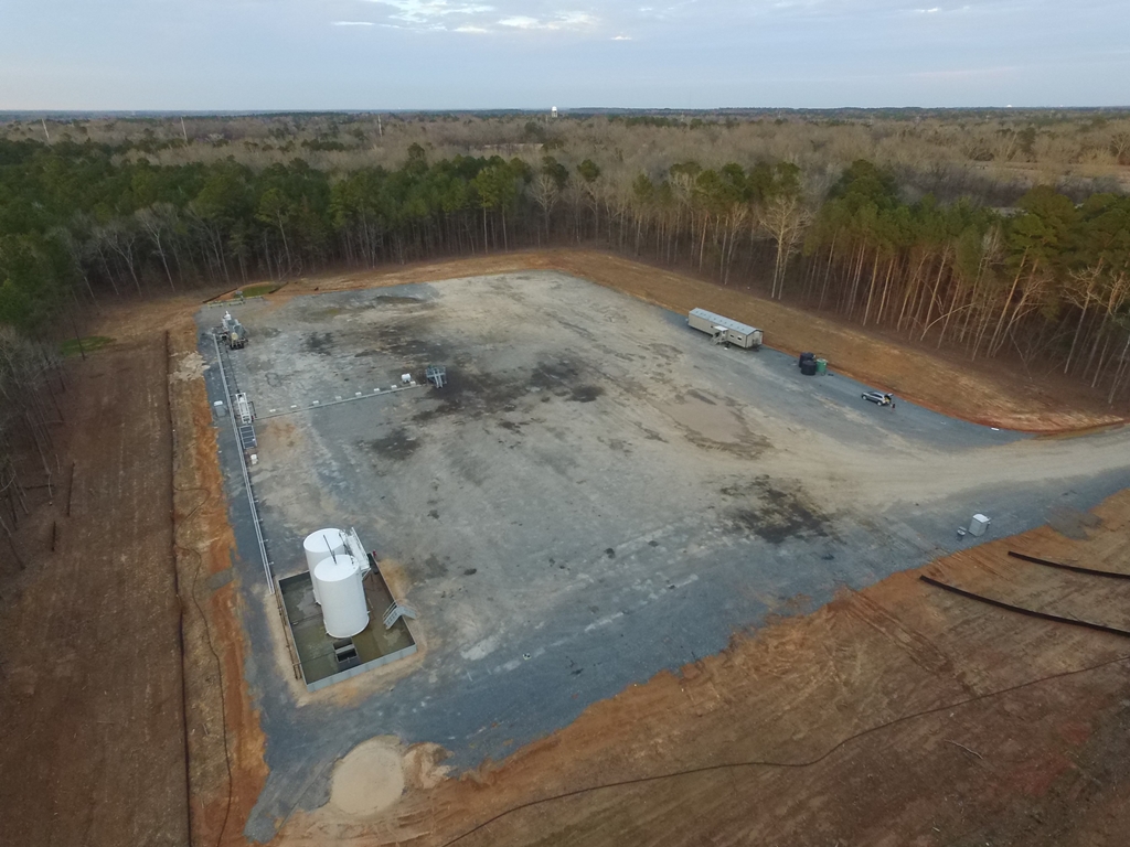

The scope of the project portfolio required multiple oil well drilling sites to be both Geo-Located related to State Plane coordinates, and photographed. The sites were photographed by the drone as shown here. Multiple pictures were obtained from various different angles to facilitate the project requirements. Some of the sites were already being utilized for drilling, while others were still under construction. The survey was performed without interrupting the ongoing operations, or interfering with the site work. Upon completion of the project a report was produced showing the site photographs. Additionally maps were produced showing the site's location in relation to surrounding countryside.


Column


Photometric Layout & Lighting Details:


Photometric layouts have been performed on a project specific basis. Normally this is requested to be included as part of a project plan packet for site development submittals. These photometric layouts are produced by software which is an add-on to the Autocad platform. These layouts include the Luminare Lighting details included in the respective photometric layouts. These details can be customized via software, to be appropriate to reflect project needs. In addition to these graphs, a photometric schedule can also be included in the plans. A finished map is produced showing footcandle strengths at various locations on the project site. These are utilized to adhere to specific local regulations, and requirements. The layout shown here was performed for the Highland Hospital parking lot in 2018.

Column


Autoturn Site Layout:


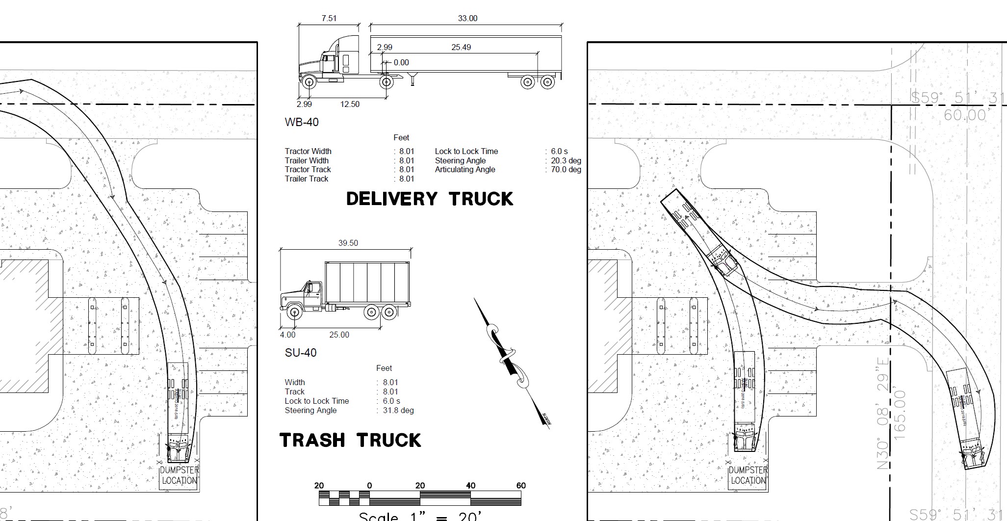
Projects are required to have a layout by certain municipalities showing what's called a "truck pathway" through a newly constructed site. This path can be calculated, generated, & shown by software called "Autoturn" which is an add-on to the Autocad software platform. The specific types of vehicles can also be customized and selected for the pathways. As shown in the example here, two types of trucks were utilized for the pathways for that project. Whatever desired pathway is needed for the project needs, can be generated by selecting the locations in the cad drawing. Once completed, the layout can then be generated to be submitted for the project. A&A has generated a number of these for various projects, and has extensive experience with the software.

https://0201.nccdn.net/4_2/000/000/046/6ea/nsps-logo.png
https://0201.nccdn.net/1_2/000/000/0b6/822/nsps_louisiana_logo.jpg
https://0201.nccdn.net/4_2/000/000/081/4ce/asce-logo-clear.png
https://0201.nccdn.net/1_2/000/000/106/ec9/facebook_logo_2023.png
https://0201.nccdn.net/4_2/000/000/046/6ea/linkedin_logo_initials.png
https://0201.nccdn.net/1_2/000/000/187/599/bbb-logo.png
0

Phone: (318) 222-5821  ●  Cell: (318) 464-5838

Email: atchleyatchleyco@bellsouth.net  ●  Mailing Address: P. O. Box 7190 Shreveport, Louisiana 71137


© Copyright 2016-2024 Atchley & Atchley, Inc. All rights reserved.

close lightbox